 Empowering agriculture with digital intelligence supporting China and influencing the world
Driven by technological advantages: Jiangsu Three&Three unmanned aerial vehicle airport unmanned operation analysis platform leads the industry
source:Jiangsu Three& three
Release time:2025-05-23
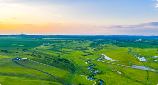
In the practical application process of unmanned aerial vehicle operation analysis platform, there are common problems in the industry, such as high lag rate of operation data analysis, disconnection between multispectral data and agricultural machinery execution system, and long iteration cycle of AI models, which seriously restrict the intelligent process of agricultural production. However, the Jiangsu Three&three unmanned aerial vehicle airport unmanned operation analysis platform has taken the lead in breaking through the barrier of perception decision execution closed-loop technology, breaking industry norms and demonstrating obvious advantages. Now, let's delve into its technological charm.
Taking the DJI M3M drone as an example, after being equipped with the Jiangsu Three&three analysis platform, its field and crop analysis technology capabilities are clear at a glance. Compared with similar products, its core advantages are highlighted in the following six aspects:
1、 Fine management equipment in the hangar responds one step faster than others
The platform has achieved a qualitative leap in unmanned aerial vehicle (UAV) hangar management by centralizing the management of the hangar, ensuring that UAVs can quickly respond to task requirements and greatly improving task execution efficiency.
2、 Multi terminal collaborative control of full cycle digital archives
The platform constructs a digital archive of the entire lifecycle of unmanned aerial vehicle (UAV) equipment, enabling multi terminal collaborative control through mobile phones or controllers, integrating control of equipment and tasks, and improving overall control capabilities.
3、 GIS precise planning of homework boundaries at a glance
In terms of flight area planning, the platform can achieve digital definition of operation boundaries based on GIS systems, automatically generate regional area and other data, provide accurate geographic information for route planning, greatly reduce manual surveying costs, and improve the accuracy and efficiency of planning.

4、 Unique crop specific analysis with full process configuration of tasks
In terms of flight mission management, the platform supports full process configuration of tasks and embeds crop remote sensing analysis algorithms. We provide specialized analysis functions for crops such as rice and wheat, including terrain analysis, hole count statistics, seedling analysis, basic seedling analysis, LAI growth monitoring, fertilizer prescription, Fusarium head blight identification, grass damage distribution monitoring, yield prediction, lodging monitoring, etc., to provide strong data support and decision-making basis for agricultural production. In addition, users can preset flight periods and route planning, generate optimal routes based on flight areas, flight types, and rotation angles, and improve operational efficiency and data collection accuracy.
5、 Comprehensive flight records with evidence for fault tracing
The platform automatically records task duration, distance, trajectory and other data, providing a powerful basis for equipment troubleshooting and performance optimization. Users can trace the device status and operation history at any time, discover and solve problems in a timely manner.

6、 Efficient algorithm analysis, precise and direct decision-making recommendations
The platform integrates flight data collection and multi-source remote sensing models, and with the help of advanced intelligent algorithms, can generate visual analysis reports in a short period of time. It can complete the analysis of 4000 acres of land in one day, intuitively presenting data analysis images such as terrain undulations, crop distribution, and lodging degree. It can also generate fertilizer prescriptions, connect with agricultural machinery and equipment such as plant protection machines, provide accurate operation guidance, and achieve a "monitoring decision-making execution" closed loop.

In the future, Jiangsu Three&Three will continuously optimize algorithms to improve the accuracy and efficiency of data analysis; Expand monitoring types and fields to meet the monitoring needs of more crops and aquatic products; Strengthen the interconnection with other agricultural equipment, build a more complete smart agricultural ecosystem, enable more farmers and agricultural enterprises to truly benefit, and promote the development of the entire agricultural industry towards intelligence and precision.

Digital Intelligence Empowers Agriculture to Help China Influence the World
JIANGSU THREE & THREE INFORMATION TECHNOLOGY CO., LTD. is a national level specialized and innovative small giant enterprise with agricultural industry digital brain, agricultural AI big model, agricultural industry model, and agricultural intelligent terminal equipment products as its core. For a long time, we have taken the industrial Internet thinking to build agriculture, rural areas and farmers. We have successfully implemented more than 580 key projects and more than 25000 customer enterprises.
Correlation dynamics
More services and support
solution
More

-
Integrated Agricultural Service Center Solution
Central kitchen solution
Integrated solution for planting and breeding
Blockchain traceability solution
Unmanned tea plantations solution
Unmanned orchard solution
Unmanned field solution
Unmanned facility solution
Unmanned livestock and poultry solution
Unmanned aquaculture solution
 Contact Us

 WeChat
 Cooperation

 Submit successfully
 Commit failure